The story of Te Kawerau ā Maki.
The iwi whose whenua, awa, and moana we are privileged to live and operate within.
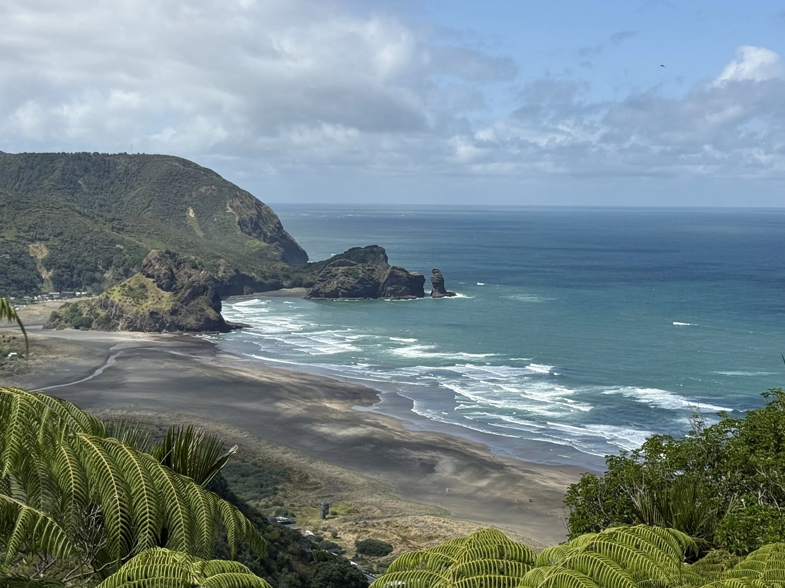
Piha from Marawhara Track.
This is a short telling of the story of Te Kawerau ā Maki — the mana whenua of Piha, of the Waitākere Ranges, and of much of what is now West Auckland. It is not a complete account. The full version belongs to the iwi themselves and is told in their own materials, in their own voice, on their own marae.
What follows is offered as an acknowledgement, a starting point, and a reminder of something all of us who live, work, or spend time here should understand: whose land we stand on, whose stories shaped it, and whose connection to it continues today.
Where the story begins.
The tribal origins of Te Kawerau ā Maki lie in the district between Tāmaki Makaurau and the northern Taranaki–Kāwhia area. The iwi are the descendants of the renowned warrior chieftain Maki and his wife Rotu, who in the early seventeenth century migrated with their family and a large group of followers from Kāwhia to what is now the Tāmaki region.
When Maki and his people arrived in Tāmaki, they were not entering unknown country. They were returning to an ancestral home that had been explored, named, and settled by their tūpuna generations before. Maki descended from prominent Tainui ancestors associated with Tāmaki — including Hoturoa, Rakataura, and Poutūkeka — and was connected to the Tainui hapū collectively known as Ngāoho, who occupied the region at the time.
The name Te Kawerau ā Maki itself comes from an incident during Maki's early years in this part of the country. While visiting south Kaipara at the invitation of a local rangatira, Maki was insulted in what came to be known as "Te Kawerau ā Maki" — "the carrying strap of Maki." The response that followed reshaped the political landscape of the region. Maki and his force defeated local hapū in a series of battles and took control of a large part of south Kaipara. Maki and Rotu's son Tawhiakiterangi — also known as Te Kawerau ā Maki — became the eponymous ancestor from whom the iwi take their name.
The reach of the rohe.
The descendants of Maki and his followers dispersed across a wide territory: south Kaipara, Te Whenua roa o Kahu (the North Shore), Hikurangi (West Auckland), Whangaparāoa, Mahurangi, Matakanakana, Pakiri, Aotea (Great Barrier Island), and Te Hauturu o Toi (Little Barrier Island). Together they are known today as the Te Kawerau confederation.
Te Kawerau ā Maki themselves, as the descendants of Tawhiakiterangi — Maki's only Kaipara-born child — developed a distinct identity in south-western Kaipara and particularly in Hikurangi: West Auckland and the Waitākere Ranges. They also occupied the northern and north-eastern shores of the Manukau Harbour and maintained important customary relationships with the Tāmaki isthmus.
By the end of the seventeenth century, Te Kawerau ā Maki exercised customary rights across south-western Kaipara, West Auckland, and the shores of the upper Waitematā Harbour. They held their land and resources under collective tribal custodianship — kaitiakitanga — with rangatira exercising authority over their tribal domain and the seas that surrounded it. Their way of life was highly mobile, built around a cycle of seasonal resource gathering across an interconnected rohe.
The Waitākere coastline as the heart of the iwi.
By 1840, after generations of European contact, epidemic disease, and the upheaval of the Musket Wars, the way of life of Te Kawerau ā Maki had become increasingly centred on the Waitākere coastline between Piha and Muriwai. This coastline was the heart of the iwi at the time Te Tiriti o Waitangi was signed, and it remains at the heart of the rohe that includes Piha today.
Unlike many parts of the country, the Treaty was never brought to southern Kaipara or the Waitākere area for signing. As a result, many members of Te Kawerau ā Maki remained physically and politically distant from the Crown during the 1840s — a circumstance that would have profound consequences in the decades that followed.
What was taken.
The history that follows is difficult reading in places. It is the iwi's own account, reflected in the official settlement record, and it is something every person who lives in or visits this land should understand.
From 1841, the Crown began acquiring vast tracts of land in the region, including a 110,000-acre block called Mahurangi and Ōmaha, extending from Maungauika (North Head) to Te Ārai. Te Kawerau ā Maki were not consulted. No systematic investigation of customary rights was carried out. No payment was recorded as being made to them.
Between 1844 and 1845, the Crown waived its right of pre-emption — its monopoly on purchasing Māori land — and allowed private individuals to negotiate directly with Māori. The regulations that should have protected Māori interests were not applied. Through these transactions, Te Kawerau ā Maki lost land across West Auckland and the upper Waitematā Harbour, including places of deep ancestral significance: Te Toangāwaka, Te Kotuitanga, Waitahurangi, Motu Karaka, and Tītīrangi — the sacred hill named by the Tainui ancestor Rakataura, from whom Te Kawerau ā Maki descend.
From 1848, the Crown commenced a systematic programme of land purchasing to the west and immediate north of Auckland, seeking land for settlers and control of the rich timber resources of the Waitākere Ranges. In 1853 and 1854, the Crown acquired around 100,000 acres in the Waitākere Ranges, in the heart of the Te Kawerau ā Maki rohe.
The Crown did not adequately investigate customary rights. It only dealt with Te Kawerau ā Maki after purchasing land from other iwi. No reserves were set aside for Te Kawerau ā Maki in the large Hikurangi block. The Piha and Waitākere Native reserves, which were created for Te Kawerau ā Maki, were not protected from later alienation.
From the mid-1860s, the individualisation of title through the Native Land Acts made what remained — including reserve lands — increasingly susceptible to partition, fragmentation, and alienation. This process continued throughout the twentieth century. Between 1920 and 1951, the Crown acquired the remaining Te Kawerau ā Maki interests in the Kōpironui and Puketāpu blocks through compulsory purchases and Public Works Act takings for sand-dune reclamation, despite Te Kawerau ā Maki protest.
The Crown's actions and omissions left Te Kawerau ā Maki virtually landless. By the time settlement negotiations began in the 2000s, the iwi held title only to the inaccessible Taitomo Island at Piha and a five-acre residue at Kōpironui. Te Kawerau ā Maki had no marae or urupā of their own.
This is the land we walk on. These are the consequences of the history we live within.
The settlement and what came after.
In 2008, the Crown formally recognised the mandate of the Te Kawerau Iwi Authority to negotiate a comprehensive settlement of the iwi's historical Treaty claims.
In February 2014, after years of negotiation, the Deed of Settlement was signed at Makaurau Marae in Māngere. The settlement was ratified by 99 percent of valid Te Kawerau ā Maki votes — a remarkable level of support that reflected both the significance of the settlement and the length of time the iwi had waited for it.
The settlement included a formal acknowledgement by the Crown that it had breached Te Tiriti o Waitangi and its principles, together with an apology recognising the long-held and deeply felt grievances of the iwi. It returned nine sites, including land at Te Onekiritea Point in Hobsonville for the iwi to establish their first marae and land at Te Henga for an urupā.
Statutory acknowledgements were placed over significant areas including Te Henga, Goldie Bush Scenic Reserve, Whatipū Scientific Reserve, Te Waitākere River, Kumeū River, and the Te Kawerau ā Maki coastal area. Seventeen geographic names were assigned or restored. Financial redress of $6.5 million plus interest was provided.
It was, in the Crown's own words, an effort to lift the burden of grievance so the process of healing could begin. It was not a restoration of what had been lost — no settlement could fully achieve that. Rather, it marked the beginning of a new chapter and a new relationship.
Te Kawerau ā Maki today.
Te Kawerau ā Maki are now governed by the Te Kawerau Iwi Settlement Trust, which holds the mandate to act on behalf of the iwi in their dealings with the Crown, Auckland Council, and the wider community. The iwi have an active and growing presence in the conservation and cultural life of West Auckland — as kaitiaki of the Waitākere Ranges, as a partner in resource management decisions, and as a voice in how this land is cared for.
The marae at Te Onekiritea Point in Hobsonville is the first marae the iwi has held in modern history — a place to return to, and a place from which to build forward.
The history of Te Kawerau ā Maki is not simply a story of the past. It shapes how many of us understand our place here today. Te Tiriti o Waitangi did not extinguish mana whenua, nor did settlement erase the relationship between iwi and their ancestral lands. That relationship continues.
Te Tiriti created a relationship between tangata whenua and those who came later. For many of us, that means understanding ourselves not as owners of this place, but as guests with responsibilities to the land and to the people who have cared for it across generations.
The streams we drink from, the bush we walk through, the coastline we stand on, and the maunga that watch over this place will outlast all of us. Our role is to care for them well, and to leave them in better condition than we found them.
How to be a respectful visitor or resident.
A few things worth knowing if you live in Piha or are visiting.
Te Kawerau ā Maki are the mana whenua of this land. When you speak of Piha, the Waitākere Ranges, the streams, beaches, and ridgelines that make this place what it is, the iwi are part of how you understand all of it.
When you walk the tracks — particularly past sites such as Te Ahua Pā on the Mercer Bay Loop — you are walking through places of deep cultural significance. Stay on the track. Treat what you encounter with care. Read the interpretation panels when they are there.
When you encounter te reo place names — Piha, Karekare, Anawhata, Whatipū, Te Henga, Marawhara, Kitekite — these are not decorative. They are the original names of these places, carrying histories, stories, and meanings that long pre-date European settlement. Learn to say them. Use them.
When visiting the maunga, the awa, the bush, or the moana, behave as a respectful guest. This place has been cared for across generations and will remain long after any of us are gone. We are all, at best, temporary stewards of something far more enduring than ourselves.
A note on this piece.
This article draws on the official Te Kawerau ā Maki Deed of Settlement (2014) as the source for the historical account, and on the Crown's settlement summary documents for the redress information. Both are publicly available.
For more on Te Kawerau ā Maki today — including current marae development, environmental work in the ranges, and guidance on engaging appropriately with the iwi — visit their official website.
This piece will be updated as the relationship and the kōrero continue to develop. If you are of Te Kawerau ā Maki and would like to correct, expand, or contribute to this account, please get in touch.